

Stirley by drone - credit: SimmGurrPhotography
Stirley
Location
OS Map Reference
SE 1459 1354View on What3Words

Know before you go
Dogs
Please pick up after your dog as dog faeces can spread neospora to the cattle which can be fatal.
When to visit
Opening times
Public rights of way around the reserve are always open and we encourage you to explore, or check out the events pages for what's happening this month.Best time to visit
May to September
About
Views and moos
Here on a hill on the edge of the Pennines, your senses are in for a treat. The first thing you notice is the quietness, interspersed with a few peaceful sounds – the buzz of bees or the chatter of our fantastic volunteers working in the vegetable patches. And then there are the views: the hills, the ancient folly of Castle Hill, and lush green meadows, where you might spot our roving traditional breed cows. The wildflowers growing outside the barns, in the verges and hedgerows create a beautiful aroma, and ‘wildest’ visitors might enjoy a foraged fruit or herbal tea.
Yorkshire Wildlife Trust bought the site in 2011 and since then has restored an old barn into an excellent facility (the Cre8 Barn Centre), developed a thriving food garden, planted an orchard, and provided conservation training to a host of young people. It demonstrates how wildlife-friendly grazing methods can benefit the landscape and involve the community – a healthy environment for wildlife supporting healthy living for people.
Bringing wildlife back
Stirley is a patchwork of habitats, designed to increase the number and diversity of flowers, insects, birds and mammals. We are re-seeding large areas of grassland with wildflower seed, planting and managing hedgerows and scrub, encouraging rough grassland as a hunting ground for birds of prey, and creating ponds, which will be full of life. From deer galloping across the fields to kestrels hovering above, Stirley just goes to show how wildlife can thrive on the edge of a big town. If you wait until dusk, maybe you’ll spot a barn owl swooping across the horizon.
History
Stirley was once an upland dairy farm that was then abandoned for almost ten years, when ends would not meet. During this time of neglect the farm buildings became derelict and in a state of disrepair. People regularly used the public rights of way through the site, but a lot of potential for use as a green space was going to waste.
As the owners of the farm buildings and land, Kirklees Council approached the Yorkshire Wildlife Trust about the site and nature conservation, whilst input from local activists suggested there might also be some benefit to the community to be gained from renovating the site.
Seasonal highlights
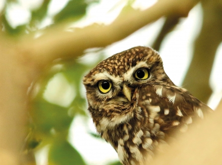
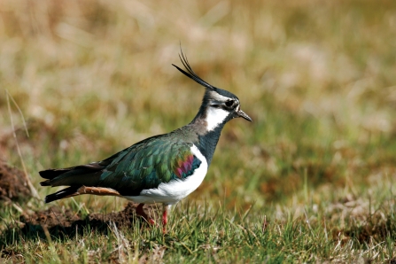
- Spring: Birds - Little owl; Invertebrates - Orange tip; Peacock; Speckled wood
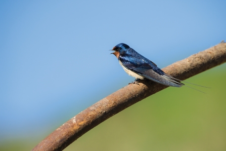
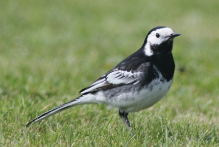
- Summer: Invertebrates - Meadow brown; Birds - Swallow; Pied wagtail; Goldfinch
- Autumn: Birds - Starling
- Winter: Birds - Kestrel
Directions
Public transport
Nearest train stations are Berry Brow and Honley. From these the site is 20 minute walk.
Bus 354 from Huddersfield to South Crosland stops at the junction of Hall Bower and Ladyhouse Lane.
Bus 341 from Huddersfield to Stocksmoor stops on Ashes Lane at the top of Cold Hill Lane.
By car
If you’re using a satnav or navigational app such as Google Maps then we recommend you avoid setting directions to ‘Stirley’ as this route may take you down a narrow track which is unsuitable for vehicles.
We advise setting directions to ‘Hall Bower Lane’ or postcode ‘HD4 6RW’.
If you are descending from the High Lane direction then continue past the housing on Hall Bower Lane and, when you reach the bend, the turning for Stirley will be on your left hand side. Follow the gravel track straight up to the end where you will see our car park.
If you are arriving from the Lady House Lane direction, the turning for Stirley will be on your right hand side as the bend in the road meets Hall Bower Lane. Follow the gravel track straight up to the end where you will see our car park.’
The What3Words address for the gravel track that takes you to Stirley is 'cared.soda.cloak'.
From Huddersfield: Take the A616 then turn left onto Bridge St, next turn left onto Lockwood Scar. Take a slight left onto Church Lane, continue onto Jackroyd Lane. Follow this up the hill, where it becomes High Lane and then take first right onto Hall Bower Lane (if you reach a T-junction at the top of the hill, you've gone too far). Follow the road through the housing and as the road drops down turn left onto a track just before the bend onto Lady House Lane. The car park will be just ahead on the right.
From the M1: Take junction 38 to Huddersfield. Take the second exit at the roundabout onto the A637. Cross two roundabouts then at the third take first exit onto the A642. Turn right onto Station Road, then right onto the A629. Turn left onto Fenay Lane and continue to Ashes Lane. Turn right onto High Lane down a steep hill. Take the first left onto Hall Bower Lane. Follow the road through the housing and as the road drops down turn left onto a track just before the bend onto Lady House Lane. The car park will be just ahead on the right.
The postcode supplied should get you to the bottom of our access track, just outside of Hall Bower village. Please follow the access track all the way to the top where you will see parking facilities and our buildings.
Please note: During larger events there is limited parking available on site, which is prioritised for people with mobility issues. During these events please park at Castle Hill, walk back to Ashes Lane and turn left, the footpath to Stirley is opposite the bus stop on the right and near Castle House Farm Cottages.
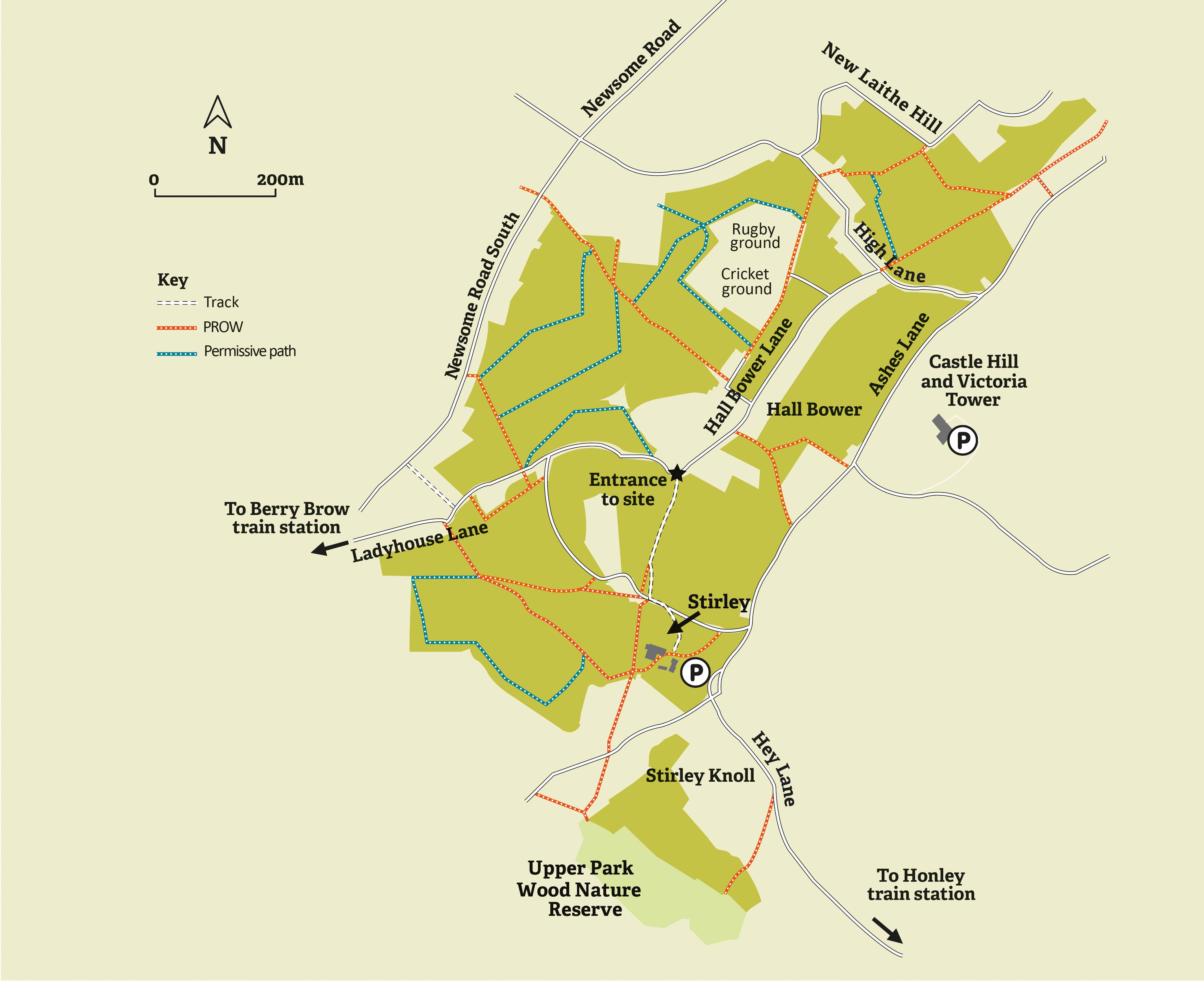
Click the map above to take a closer look

Magical Moment
A magnificent sparrowhawk gliding overhead.

The autumn colours were even more beautiful when the sun came out
Photo Credit - Telling our Story Volunteer, Sara


