
Rifle Butts Quarry Nature Reserve
Location
OS Map Reference
SE 89841 42620View on What3Words

Know before you go
Dogs
When to visit
Opening times
Open at all timesBest time to visit
May to SeptemberAbout the reserve
The exposed rock face in Rifle Butts Quarry is a geological timeline, starting with brown mudrocks from the early Jurassic age. Above this layer is the 'unconformity', revealing a period of 80 million years when sediments deposited on the mudrocks were removed by erosion. This exposure is protected under a shelter to stop it eroding.
Over 150 plants have been recorded here. The site erupts with wildflower colour in spring and summer- cowslip, marjoram, lady's bedstraw, clustered bellflower and many more - attracting butterflies including marbled white.
The Trust works to protect the rock exposure and the chalk grassland. Hawthorn and elder scrub is removed from the most important grassland areas and the site is grazed with Hebridean sheep.
Accessibility and facilities
Nearest facilities are in Market Weighton.
Mobile coverage is reasonable depending on your provider.
///validated.skip.ribcage for Rifle Butt's kissing gate entrance.
Habitat
Environmental designation
Seasonal highlights
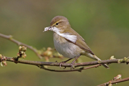
- Spring: Plants - cowslip; primrose Birds - Willow warbler
- Summer: Plants -greater knapweed; majoram Invertebrates - yellow meadow ant; small copper; common blue
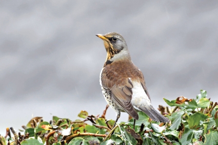
- Autumn: Birds - fieldfare; redwing
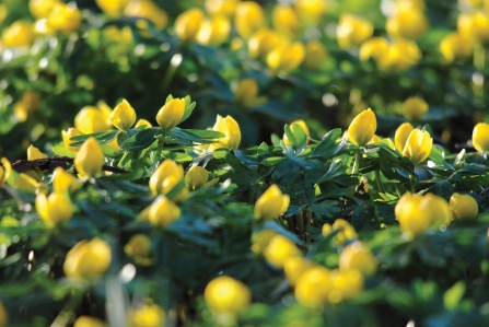
- Winter: Plants - winter aconite
History
Rifle Butts Quarry was created to provide stone for the construction of the railway line adjacent to the nature reserve.
The site was then used as a rifle range from the 1890s to the First World War.
Today it is important as a geological site and relict chalk grassland.
Directions
Public transport
Market Weighton is served by buses from York and Goole via Holme-on-Spalding-Moor. The Hudson Way cycle route runs on a disused railway line between Market Weighton and Beverley.
By car
After passing Martket Weighton Secondary School continue straight on at the next junction. A mile further on take a sharp turn left, go between the embankments where a bridge once took the Market Weighton – Beverley railway line over the road. The site is on the right hand side at the end of the first field and parking is on the wide grass verge in front of the nature reserve. Please don’t block the gate into the field next to the site.
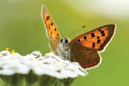

Marbled White (Melanagria galathea) - Guy Edwardes/2020VISION
Magic Wildlife Moment
The monochrome magic of marbled whites

The autumn colours were even more beautiful when the sun came out
Photo Credit - Telling our Story Volunteer, Sara


