
Mid–Swale Nature Recovery project
Where is the River Swale
The River Swale is said to be one of the fastest flowing rivers in England. It starts at the confluence of Birkdale and Great Sleddale Beck in the Yorkshire Dales, passing through many towns and villages before joining the River Ure near Myton-on-Swale.
The Mid-Swale project focuses on the area between Richmond and Catton.
Our key aims
Floodplains and wetlands are essential habitats for a variety of wildlife. However, changes in land use have resulted in the loss of many of these areas over time. This has had a notable impact on the wildlife that call these habitats home, causing widespread population declines.
Our aim is to work with landowners to restore, enhance and recreate these vital habitats, whilst also reducing agricultural run-off and potentially lowering flood risk.

What are the issues?
Over 50% of historic wetland habitat has been lost from the mid-Swale area since the early 19th Century, and much of what remains is severely fragmented. As well as playing a large role in how water moves through a landscape, wetlands are a key component of river habitat connectivity and provide breeding and feeding ground for many bird, mammal and invertebrate species.
The main issues are:
- Lack of or disconnected floodplains
Floodplains are the flat areas surrounding a river or stream. When a river floods the water moves into the floodplain which helps the water to lose its force and reduce flooding downstream. As the water drains away it deposits silts onto the land, creating a specialist habitat for plants and wildlife.
- Decreasing wetlands
Wetlands are areas that generally hold water most of the time and include ponds, marshes and bogs. These areas may help to filter polluted water, reduce flood risk and again play host to specialist wildlife.
- Agricultural run-off
This is a term used for water ‘running off’ the land particularly after heavy rain fall; bringing with it loose sediments and pesticides which wash back into the river.
How can you help
If you own or manage land close to the Swale, Wiske or their tributaries and would like to know more about the project please contact Claire Burton at claire.burton@ywt.org.uk for more information.
You an also join our Facebook page here.
Funders
Environment Agency and Daniell Trust
Our work
YWT aims to work alongside landowners to tackle the above issues through education and practical land management. It is highly important that the works carried out benefit both the wildlife and the landowner.
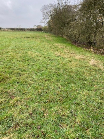
Before work – Nov 2021 Previously grazed field, becomes waterlogged and unusable in the dip near the hedge line.
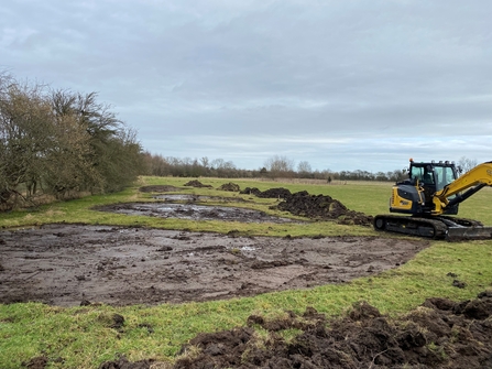
During scrape creation – Feb 2022 Four small scrapes starting to take shape.
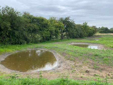
Completion - The scrapes were completed early March 2022 and revisited in July 2022. A follow up visit took place in June 2023 (next photo).
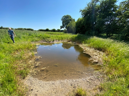
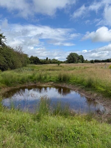
The June visit gave away its wildlife secrets; wetland vegetation such as Branched Bur-reed beginning to grow, dragonfly exuvial (the cast from a dragonfly where it has left the water as a nymph and hatched as a dragonfly) attached to the grasses; meaning they must have laid eggs in the water last year and the adult Broad-bodied chaser dragonflies zooming about plus invertebrates such as water beetle swimming around.
At the waters edge deer, badger and numerous bird prints were found. All this has happened in just over a year, wildlife is amazing!