
Wilthorpe Marsh and Canal
Location
Smithies
OS Map Reference
SE34614 07914 (car park on Smithies Lane)View on What3Words

Know before you go
Dogs
When to visit
Opening times
Open at all timesBest time to visit
March to SeptemberAbout the reserve
A gateway to a wilder world
You're barely out of Barnsley town centre before you reach the gateway into the Upper Dearne Valley and step out into an extensive wetland oasis.
Following the course of the old canal, you'll get great views over the valley's cut-off meanders, swamps and sprawling reedbeds. The canal bed is dry at first as you head west from the car park, where you'll see crack willow growing. This soon gives way to a wetter marsh, then the water opens up, providing an excellent habitat for amphibians, including great crested newts.
Stop to admire the interesting plants that grow here, especially the only population of frogbit in the Barnsley area. Frogbit floats on the water's surface, looking like a small water lily, with sweet, three-petalled white flowers that bloom in July and August.
Winter can be a great time to look for some of the more unusual bird species that sometimes visit the marsh, including jack snipe and water pipet, with raptors like peregrines and merlins hunting for prey.
Life over the hedge
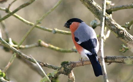
To the south of the site, bee orchids bloom in the summer in the open grassland. To the north, the longest continuous hedgerow in Barnsley provides food and shelter for flocks of birds that include rare willow tits, thrushes and bullfinches.
The Trust is working on the site to create a better habitat for willow tits to colonise, by creating an open canopy in the young woodland that grows alongside the canal.
Environmental designation
Seasonal highlights
- Spring: Birds - Willow tit; Grasshopper warbler; Great crested newt
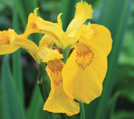
- Summer: Plants; Frogbit; Field scabious; Yellow flag iris; Birds - Reed bunting
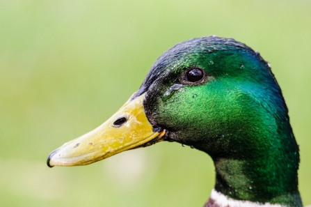
- Autumn: Birds - Mallard; Teal; Gadwall; Green woodpecker
- Winter: Birds - Water rail; Bullfinch; Kingfisher; Great spotted woodpecker
Directions
Public transport
Buses from Barnsley Interchange to Honeywell - Athersley South stop near the site.
By car
From M1 take A628 to Barnsley Centre. Take A61 north to Smithies, take Smithies Lane on left at traffic lights. Pass fishing pond on rihgt, after 200m park in small car park on right opposite Barnsley College Smithies annex.
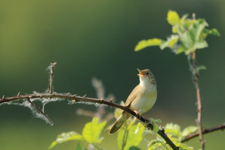
Grasshopper Warbler (c) Amy Lewis

Magical Wildlife Moment
Spotting a kingfisher perched by the disused canal as you walk along the towpath

The autumn colours were even more beautiful when the sun came out
Photo Credit - Telling our Story Volunteer, Sara


