(c) Amy Lewis


Grasshopper Warbler (c) Amy Lewis
Staveley Nature Reserve
Location
OS Map Reference
SE 36991 63039What.3.words///spoons.dose.bogus

Know before you go
Dogs
Please respect the grazing animals.
When to visit
Opening times
Open at all times. We recommend a full day outing for this reserve – and if you’re in the area for longer, why not visit Bishop Monkton Railway Cutting, Burton Leonard Lime Quarries and Ripon City Wetlands?Best time to visit
June to SeptemberAbout the reserve
A year-round wild refuge with an industrial past, Staveley offers wildlife a large space and variety of habitats to move around. With accessible paths and five bird hides – three fully accessible – there are lots of great opportunities to absorb yourself in nature and wonder at the incredible number of birds that it plays host to, including enormous numbers of geese and lapwings. It’s easy to get to – just ten minutes’ drive from the A1M.
Staveley is a great place for seeing otters, sometimes in the middle of the day. You might also see roe deer, foxes and, if you sit very still in a quiet spot, you might glimpse two much smaller mammals – the water shrew and harvest mouse – particularly around dusk and dawn.
Common breeding birds include several warbler species, with common terns on the rafts created for them and barn owls in nest boxes. Little ringed plovers, avocets and oystercatchers sometimes breed, while in winter the lagoons are home to pintails, wigeons, goldeneyes, snipe and shovelers. Rarer visitors include bitterns.
Contact us
About
Staveley Nature Reserve, part of a larger area known as Staveley Carrs, has been renowned for rare plants for centuries. Today, this large, accessible site has been sculpted through quarrying activities followed by decades of work by Yorkshire Wildlife Trust and dedicated volunteers.
The site is in two parts: the East Lagoon edged with vegetation that was allowed to develop naturally post quarrying, comprising fen, reed swamp, scrub and flower-rich grassland; and the West Lagoons, which was landscaped and returned to agricultural usage after quarrying, with arable and intensively grazed areas. This part of the site has seen much activity to create more interesting wildlife habitats, since the Trust’s purchase of the land in 2010.
An 11 hectare hay meadow has been created on a former arable field, islands, nesting platforms and a sand martin wall have been built around the lake, and ponds and scrapes put in to increase the area of wetland habitat. The nature reserve is bordered by the River Tutt on its northern boundary and there are footpaths and hides from which to observe the varied wildlife.
Small areas of fen are home to several relic species which were once widespread before the carrs were drained and transformed into farmland. Locally scarce species such as water violet, marsh helleborine and meadow rue can be found.
Common breeding birds include summer visitors such as sand martin and several species of warbler, with common tern breeding on the rafts put out for them and barn owls in nest boxes. Wading birds such as little ringed plover and oystercatcher sometimes breed on the exposed bare ground and islands of West Lagoon. Red kites and buzzards are regular visitors. There have been 22 species of damselflies and dragonflies recorded in the main lagoons, small ponds and ditches.
Mammals are well represented with roe deer and fox amongst the larger species and water shrew and harvest mouse amongst the smaller species. Otters are seen regularly, quite often in the middle of the day on both lagoons.
Management of the nature reserve is designed to maintain the site’s diverse habitats with rotational reedbed management, scrub clearance and coppicing, cutting and raking of grassland, traditional haymaking and grazing with the Trust’s Highland cattle, and Hebridean sheep, amongst other activities.
Seasonal highlights
- Spring: Inverterbrates - Orange-tip; Large red damsefly; Birds - Commen tern; Sand martin Mammals - Otter
- Summer: Plants - Marsh helleborine; Common spotted orchid; Bee orchid; Invertebrates - Peacock butterfly; Birds - Barl owl
- Autumn: Birds - Teal; Shoveler; Greenshank; Inverterbrates - Migrant Hawker
- Winter: Birds - Red kite; Tufted duck; Reed bunting; Tree sparrow
Directions
Public transport
Bus routes pass through Staveley village.
By car
On the northern outskirts of Staveley, 2.5 miles south west of Boroughbridge. Car park just out of the village on the Minskip road and also disabled access via radar key from the track next to the church on Main Street. Public footpaths cross the site from Staveley Main Street next to the pub and from the Minskip road.
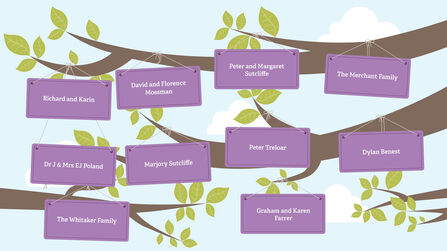
Staveley is an important reserve that is loved by many. Our digital In-Memory tree celebrates the people who have supported Staveley over the years. We want to say thank you to all of the names that appear on the leaves.