For the latest updates on Denaby Ings, please check the updates section below.

Sunset at Denaby Ings (c) Nabil Abbas

Avocet © Barry Wardley 2020

Bee Orchid (c) JudithGreaves

Spoonbill (Platalea leucorodia) feeding with water dripping from its bill, Brownsea Island, Dorset, winter. - Bertie Gregory/2020VISION
Denaby Ings Nature Reserve
Location
OS Map Reference
SE 49831 00843 (car park)SE 50636 00691 (lay-by parking)
View on What3Words

Know before you go
Dogs
When to visit
Opening times
Open at all times. We recommend a half day visit, but Sprotbrough Flash is very close by so why not make a full day of it?Best time to visit
August to NovemberAbout the reserve
Space to breathe
A green lung close to South Yorkshire’s urban heart, Denaby Ings is a haven for wetland and woodland wildlife, in a landscape that’s been chopped and changed many times over its history.
Even the river Dearne has changed course – the reserve sits on its old course and next to its straightened new course, and the lake was formed when the river was blocked off by tipping coal spoil from a nearby mine. Trees where herons, little egrets, great white egrets and even the odd spoonbill occasionally roost show the Dearne’s historical route. Areas of open water have formed where the river used to flow and these are now rich in aquatic life.
The raised embankment that takes you to the two hides was previously the Dearne Valley Railway, which transported coal from the local mines. The hides offer excellent views out over the main marsh and open water across to wooded crags in the distance, and great vantage points for seeing goosanders, kingfishers and other birds.
Holding back the floods
In spring and summer, the reserve fills with the sound of birdsong, and flowers, including several species of orchid, bloom in the meadows, visited by abundant butterflies.
Denaby Ings also plays an important role in flood relief. When there’s severe flooding, the river can be diverted so that water escapes into the meadows, and can be slowly released after the flood’s peak, providing a mix of reedbeds and muddy shoreline that attracts several species of wading birds, including avocets, bitterns and green sandpipers.
Contact us
Environmental designation
Updates
The Environment Agency are doing some work on the sluices which control the water flow between Denaby Ings and the River Dearne and so the circular path round the site may be flooded here: https://what3words.com/freely.decide.puzzle as they have to keep the sluice open.
Work is expected to take place between now and Christmas and this area of the permissive path will be closed until work completes. This will mean you cannot walk the circular loop round the reserve. The site can still be accessed from the main car park, and it will not affect access to the bird hides.
Seasonal highlights
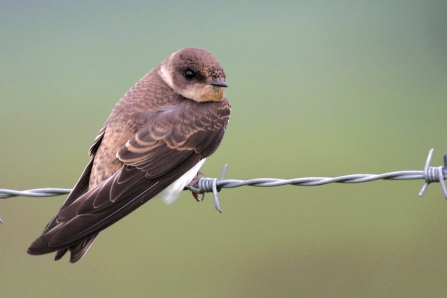
- Spring: Birds - Avocet; Sand martin; Sedge warbler; Grasshopper warbler
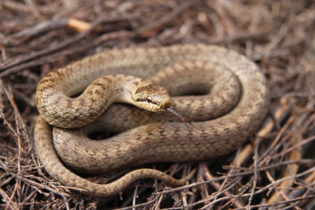
- Summer: Plants - Bee orchid; Pyramidal orchid; Common spotted orchid; Reptiles - Grass snake
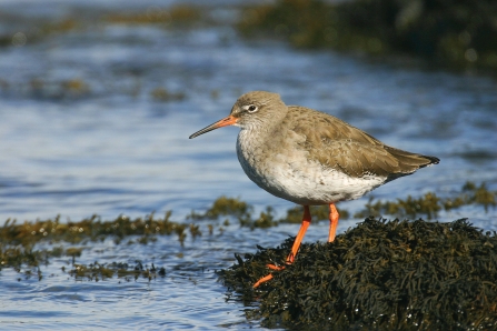
- Autumn: Birds - Little egret; Common sandpiper; Green sandpiper; Wood sandpiper; Redshank; Greenshank; Black-tailed godwit
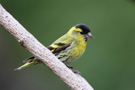
- Winter: Birds - Bittern; Goosander; Siskin
Directions
Public transport
Train to Conisbrough or Mexborough from Doncaster, then approximately a 30 minute walk to the nature reserve.
By car
Denaby Ings lies north east of Mexborough. From Mexborough, take the A6023 and turn left down Pastures Road on the outskirts of the town. Follow this north east for 1 mile and then turn right into the car park shortly after crossing the River Dearne

a recent photo of Great White Egret © Steve Ditch 2019
Magical Wildlife Moment
An exotic-looking spoonbill, whooper swan or great white egret joining gry herons and little egrets to roost.

The autumn colours were even more beautiful when the sun came out
Photo Credit - Telling our Story Volunteer, Sara


