
Connor Byers
Stoneycliffe Wood Nature Reserve
Location
OS Map Reference
SE 2751 1603View on What3Words

Know before you go
Dogs
When to visit
Opening times
Open at all timesBest time to visit
June to SeptemberAbout the reserve
Calming and charming
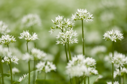
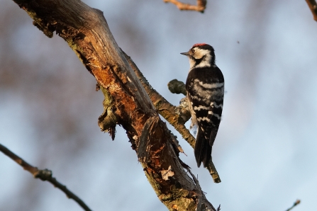
This stunning woodland, with its meandering beck, charms visitors with bluebells and wild garlic in spring, breeding birds in summer, and fungi in autumn. Stoneycliffe Wood’s trees are mostly oak and birch, with some amazing veteran sweet chestnuts, and areas of wet woodland with alder and willow. Listen for the high-pitched call of treecreepers, which you might see climbing up the trees in search of food. There’s a chance of seeing all three species of woodpecker here. They feed on the many insects in the dead wood, which provides an important habitat. Several rare spiders have been recorded too. You might also encounter mammals including stoats, voles, shrews, and foxes.
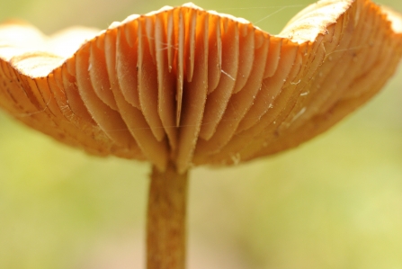
This is a great place to spot interesting fungi in autumn, including fly agaric, jelly ears, puffballs, and chicken of the woods, which gets its name from the texture and taste of its flesh, said to resemble cooked chicken.
After the glorious springtime displays of bluebells and wild garlic, summer flowers include the lovely yellow archangel. By the stream, look for wood club-rush, hemlock water dropwort and Sprengel’s bramble.
Glades and halo thinning
Historically, Stoneycliffe Wood was managed for timber production, but we now manage it to protect the older trees by halo thinning – removing newer trees from around the mature ones to prevent overcrowding and improve the structural diversity of the woodland. Creating glades helps too by allowing for more scrub cover on the woodland floor, which is ideal for birds including chiffchaffs. Felled timber is now left on site and, in summer, spotted flycatchers are among the birds that benefit from the insect life that thrives on the decaying wood.
We control Himalayan balsam and bracken to make sure they don’t swamp the woodland flowers.
Habitat
Seasonal highlights
- Spring: Plants - Bluebell; Wild garlic; Birds - Chiffchaff
- Summer: Plants - Yellow archangel; Birds - Spotted flycatcher; Stoat;
- Autumn: Fungi
- Winter: Birds - Lesser spotted woodpecker
Directions
Public transport
Buses that run from Wakefield to Huddersfield pass through Netherton. Exit on Upper Lane (Coxley View).
By car
The nature reserve is on the western edge of the village of Netherton. A footpath enters the site near the Star Inn. Another entrance is alongside Netherton Cemetery and a third footpath enters from the signposted entrance road to Earnshaw's Timber Centre, almost in Midgley.


Connor Byers
Magical Wildlife Moments...
The late summer sun streaming through the still-green leaves onto the woodland floor by the rippling beck.

The autumn colours were even more beautiful when the sun came out
Photo Credit - Telling our Story Volunteer, Sara


