
The INNS team drowning in Himalayan balsam at Adel Dam
Tackling Invasive Species
What are Invasive non-native species?
Invasive non-native species (INNS) are species that have been introduced (often by humans both intentionally or accidentally) to areas outside their normal geographic range. INNS rank only second to habitat destruction as the biggest threat to biodiversity; they can alter local ecology, decrease biodiversity, spread disease and parasites, clog waterways and, in the case of Giant hogweed, even cause physical harm to humans. They cost the UK economy approximately £2bn per year.
We are lead partners in the Yorkshire Invasive Species Forum (YISF) which aims to provide a joined-up approach to tackle the issue of invasive species in our region. The forum was set up in 2012 with the overall objective of bringing together all those working to manage the problem. We work with these organisations and individuals (including dedicated volunteers) to record and map the presence of invasive species and the management being undertaken. Using this information, and with the support of our partners and volunteers, we are creating a long term, sustainable way of working for tackling invasive species found along our waterways.
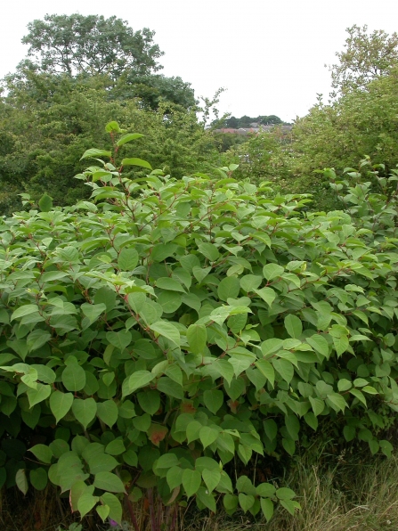
(c) Philip Precey
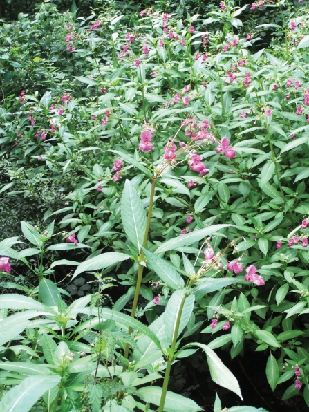
(c) Carys Hutton
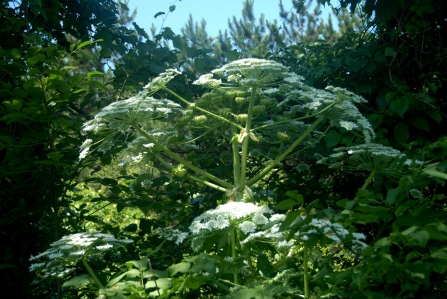
Giant Hogweed (c) Antetixux21
INNS Mapper
INNS Mapper has launched! Download the new app & visit the website to be able to report sightings, surveys & the management of invasive non-native species (INNS) in England, Scotland & Wales.
Key Aims
As part of the Yorkshire Invasive Species Forum, we are developing a sustainable programme to tackle the INNS problem in Yorkshire. The forum develops and implements strategic control, treatment and management plans, by working in partnership with organisations and individuals across the region who are fighting to control INNS.
Alongside this, we are helping to help 'stop the spread' by promoting good practices to anyone and everyone. In particular, we work to promote the GB Non-Native Species Secretariat 'Check Clean Dry' campaign, encouraging people who have been near INNS to check their equipment and clothing, clean it and leave it out to dry,
What we are doing
The main work of the forum involves monitoring and surveying the distribution of INNS. As part of the forum we work with volunteers to carry out surveys and treatment. We have worked with partners to develop an app and online web-based tool called INNS Mapper which can be used to report INNS in Yorkshire and across GB, as well as allowing you to see the spread
We also carry out INNS treatment in 'prioirity catchments' around Yorkshire. This involves working closely with landowners, raising awareness of the environmental and legal issues of owning land with INNS present and working with landowners to develop management plans for INNS on their land. We also deliver treatment by deploying a trained team to provide a cost effective solution.
How you can help
We have a number of citizen science roles to help us map INNS across the region – with support and training. We also offer support to anyone wishing to organise local Himalayan balsam removal days.
Please email invasives@ywt.org.uk for more information.
Further information on INNS mapper
The INNS Mapper app is free to use and aims to provide an effective resource to support INNS programmes and coordinate efforts. Data reported to INNS Mapper is open access and publicly available for anyone to use.
We encourage everyone to get involved with using INNS Mapper to report sightings of INNS. For those also going out to survey and manage INNS, such as Local Action Groups (LAGs) and volunteer groups, INNS Mapper is the tool to report and share survey and management information, which will help coordinate effective INNS management.
The identification of photos provided in sighting records can be verified by users of INNS Mapper using the ‘verify’ function. Additional information on the INNS and ID guides are also available. INNS Mapper was developed and funded by multiple organisations, please visit www.innsmapper.org for information.
Interactive activities
- Alien Detectives (https://www.invasivespecies.scot/alien-detectives)
- Invasive species wordsearch (https://www.nonnativespecies.org/assets/Document-repository/Invasive_species_wordsearch.pdf)
- Invasive Species Detective game (https://www.nonnativespecies.org/what-can-i-do/training/schools-and-universities)


INNS Week
Invasive Species Week is an annual event to raise awareness of invasive non-native species and how everyone can help prevent their spread.